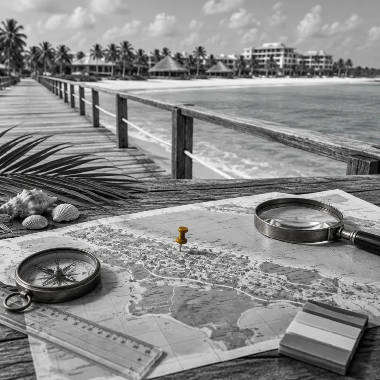
Understanding the Punta Cana resort areas comparison map before you book
A clear Punta Cana resort areas comparison map helps you match each coastal zone with your travel style. When you look at a detailed resort map of the eastern Dominican Republic, you immediately see how the long string of beaches divides into distinct sections with different atmospheres and hotel profiles. This makes it far easier to book a resort, or even combine several, that truly fit your expectations.
The main shoreline of Punta Cana stretches from Cap Cana in the south to Uvero Alto in the north. On any good Punta Cana map or hotel map, you will notice that each area clusters specific types of properties, from quiet luxury retreats to lively all-inclusive resorts with water sports and nightlife. When you compare these areas side by side on a Punta Cana resort map layout, you can quickly shortlist the right resorts or a single hotel for your stay.
Cap Cana sits close to Punta Cana International Airport and offers a sheltered marina, golf courses, and some of the most exclusive beach resort properties in the Dominican Republic. On a detailed hotel map, Cap Cana appears as a compact enclave with large villas, a few grand hotels such as Eden Roc Cap Cana and Secrets Cap Cana, and a calm beach that suits couples and golfers more than party seekers. If you want a Punta Cana hotel with a refined resort spa and quieter all-inclusive options, this Cap Cana area deserves serious attention.
Moving north on the Punta Cana map, the main resort area begins around Playa Blanca and continues toward Cabeza de Toro. Here, the Punta Cana resort map shows a mix of family-friendly all-inclusive resorts and mid-range hotels with easy access to excursions. Travellers who want to book a beach resort close to both the airport and day trips often choose this central Punta Cana stretch.
Cabeza de Toro appears on every serious resort map as a small, curved bay with mangroves behind the sand. The Cabeza de Toro area hosts several all-inclusive resorts that focus on calm water, shallow beaches, and easy boat access for snorkeling tours. If you prefer compact Punta Cana resorts with a relaxed feel, Cabeza de Toro hotels such as Catalonia Punta Cana or Dreams Flora can be a strong alternative to the busier Bávaro zone.
Farther north, Bávaro and Arena Gorda dominate any Punta Cana resort areas comparison map because they host the largest concentration of hotels. On a hotel map of Bávaro, you will see long continuous beaches lined with all-inclusive resorts, grand complexes, and multiple resort spa facilities. This is where you find the widest choice of Punta Cana all-inclusive options, from family-focused properties like Barceló Bávaro Palace to adults-only resorts such as Secrets Royal Beach.
Comparing Bavaro, Arena Gorda and Cabeza Toro on the map
When you zoom into a Punta Cana resort areas comparison map, Bávaro, Arena Gorda, and Cabeza de Toro stand out as three distinct clusters. Bávaro sits roughly in the middle of the coastline and offers the liveliest mix of beach bars, shopping plazas, and water sports. Cabeza de Toro and Arena Gorda, by contrast, feel more self-contained, with Punta Cana resorts that rely heavily on on-site all-inclusive experiences.
On most hotel map layouts, Bávaro covers several named beaches that blend into one another. You will see El Cortecito, Los Corales, and central Bávaro Beach, each lined with a dense row of resort and hotel properties that share a long, walkable shoreline. Travellers who want to book a Punta Cana hotel with easy off-site dining and nightlife usually gravitate toward this Bávaro area.
Arena Gorda lies just northwest of Bávaro and appears on any resort map as a slightly wider, more open stretch of sand. The beaches here are broad, with a gentle slope and strong waves that attract active guests and families who enjoy boogie boarding. Many grand hotels and large all-inclusive resorts occupy this Arena Gorda zone, often combining a resort spa, water park features, and extensive kids’ clubs; examples include Hard Rock Hotel & Casino Punta Cana and Bahia Principe Grand Punta Cana.
Cabeza de Toro, by comparison, shows up on the Punta Cana map as a smaller bay with calmer water and fewer independent restaurants nearby. This area suits travellers who prefer an all-inclusive resort where most services, dining, and entertainment stay within the property. If you study a detailed hotel map, you will notice that Cabeza de Toro resorts sit closer together, which makes walking between neighboring beaches easy but limits off-site exploration.
Weather patterns also influence which area you choose when you book. Before confirming a resort in Bávaro, Arena Gorda, or Cabeza de Toro, it is wise to check a focused Punta Cana weather and hurricane season guide for travellers. This helps you understand how wind, seaweed, and seasonal showers may affect specific beaches along the Punta Cana coastline.
On a Punta Cana resort areas comparison map, you will also notice how road access differs between these three zones. Bávaro connects directly to the main highway, which shortens transfer times and makes excursions to the rest of the Dominican Republic more convenient. Arena Gorda and Cabeza de Toro sit slightly farther from the central junctions, so transfers can take longer, but the payoff is often quieter beaches and less through traffic.
Uvero Alto and Cap Cana versus central Punta Cana
At the northern end of most resort map diagrams, Uvero Alto appears as a separate band of sand beyond Arena Gorda. This area feels more remote, with fewer hotels and a wilder coastline that appeals to travellers seeking space and privacy. When you compare Uvero Alto to central Punta Cana on a regional map, the difference in density and atmosphere becomes immediately clear.
Uvero Alto beaches tend to have stronger waves and a more dramatic ocean color, which many guests find visually striking. All-inclusive resorts in this area often occupy larger plots of land, so each Punta Cana resort has more room for gardens, pools, and quiet corners. Families who want a beach resort with a water park or extensive kids’ facilities often choose Uvero Alto, and a dedicated guide on how to choose the best Punta Cana resort with a water park can help refine those options.
Cap Cana, at the southern end of the Punta Cana coastline, offers a very different experience from Uvero Alto. On any Punta Cana resort areas comparison map, Cap Cana stands out as a gated enclave with a marina, golf courses, and low-rise luxury hotels. Travellers who want to book a Punta Cana hotel with a refined resort spa, quieter beaches, and upscale dining often focus on this Cap Cana area.
Central Punta Cana, including Bávaro and Arena Gorda, sits between these two extremes in both geography and style. On a hotel map, you will see that this central area hosts the highest number of all-inclusive resorts, from mid-range properties to grand hotels with extensive entertainment. If you want an all-inclusive stay with easy access to shopping malls, casinos, and nightlife, central Punta Cana usually offers the best balance.
When comparing Uvero Alto, Cap Cana, and central Punta Cana, pay attention to transfer times on the map layout. Uvero Alto can require a longer drive from the airport, while Cap Cana sits very close, which matters for short stays or late arrivals. Central Punta Cana falls in between, offering moderate transfer times and the broadest choice of resorts and hotels.
Families should also consider how the beaches differ between these areas. Uvero Alto and parts of Arena Gorda can have stronger waves, which some children love but others may find challenging. Cap Cana and Cabeza de Toro usually offer gentler beaches, making them attractive for younger families who want calm water near their all-inclusive resort.
How to use a resort map to match beaches with your travel style
A Punta Cana resort areas comparison map becomes truly useful when you link each beach to a specific travel style. Start by identifying whether you prefer calm water, lively waves, or something in between, then look at how each area behaves across the seasons. This approach turns a simple resort map into a planning tool that guides you toward the right Punta Cana resort or a combination of properties.
For calm water and sheltered beaches, focus on Cap Cana, Cabeza de Toro, and parts of central Punta Cana near the reef. On a detailed regional map, these zones often sit behind protective coral formations that soften the waves and create lagoon-like conditions. Travellers who want to book a beach resort for paddleboarding, gentle swimming, or young children usually appreciate these quieter beaches.
If you enjoy more movement in the water, Arena Gorda and Uvero Alto stand out on any hotel map overview. These beaches face more open ocean, so waves can be stronger, which suits boogie boarding, body surfing, and simply watching the surf roll in. When you choose an all-inclusive resort in these areas, check whether the hotel offers red-flag-day information and lifeguard services on its resort map or guest app.
Nightlife and off-site dining also vary significantly along the Punta Cana coastline. Bávaro, especially around El Cortecito and Los Corales, shows the highest density of bars, restaurants, and independent beach clubs on any local map. Guests who want to leave their all-inclusive resorts regularly for local food or music often prefer this central Bávaro area.
By contrast, Cap Cana and Uvero Alto feel more self-contained, with most entertainment located inside the resorts. On the resort map for these areas, you will see fewer external venues within walking distance, which suits travellers who value privacy and on-site services. If you plan to book an all-inclusive stay where you rarely leave the property, these zones can be ideal.
Excursion access is another factor that a Punta Cana resort areas comparison map clarifies. Properties in central Punta Cana and Cabeza de Toro usually sit closer to departure points for catamaran cruises, zip-line parks, and cultural tours into the interior of the Dominican Republic. Guests staying in Cap Cana or Uvero Alto may face slightly longer transfer times, but they gain quieter beaches and a more secluded resort spa environment.
Planning day trips and activities from each resort area
Once you understand the Punta Cana resort areas comparison map, you can plan day trips that match your chosen base. Central Punta Cana, Bávaro, and Cabeza de Toro offer the widest range of excursions, thanks to their proximity to marinas and highways. Travellers who book a beach resort here often enjoy a balance between on-site all-inclusive activities and off-site adventures.
From Bávaro and Arena Gorda, catamaran cruises, snorkeling tours, and party boats depart regularly along the main beaches. Many all-inclusive resorts in these areas maintain direct partnerships with excursion companies, so you can book trips directly from your hotel lobby. The hotel map or resort map usually highlights pick-up points, making logistics straightforward even for first-time visitors to the Dominican Republic.
Cap Cana, with its marina, serves as a key departure point for fishing charters and upscale yacht excursions. Guests staying in this Cap Cana area can easily arrange private boat trips or premium snorkeling experiences that depart just minutes from their resort. For travellers who value comfort and privacy, this proximity to the marina can be a decisive factor when choosing between Cap Cana and central Punta Cana.
Many visitors also use Punta Cana as a base for elegant day trips to nearby islands. If you are staying in any of the main resort zones, you can join organized excursions to Saona Island or Catalina Island that include transfers from your all-inclusive resort. A curated guide to elegant Punta Cana day trips to Saona Island from luxury hotels can help you compare options that depart from different beaches and marinas.
Uvero Alto, while more remote, still connects to many of the same activities through longer transfers. On a regional map, you will see that the main highway links Uvero Alto to adventure parks, zip lines, and cultural tours in the interior of the Dominican Republic. When you book an all-inclusive resort here, check whether the hotel offers shared or private transport for excursions, as this can influence both cost and comfort.
Golfers should pay close attention to the Punta Cana resort areas comparison map, because courses cluster around specific zones. Cap Cana and the southern Punta Cana area host several renowned courses near the coast, while additional options sit inland near Bávaro. If golf is a priority, choose a Punta Cana resort or hotel that offers shuttle services to these courses and highlights them clearly on its hotel map.
Reading hotel maps and on site layouts inside large resorts
Beyond the regional Punta Cana resort areas comparison map, each large property provides its own hotel map. These internal maps matter more than many travellers expect, especially in grand hotels and expansive all-inclusive resorts with multiple buildings and pools. Understanding the layout before you book can help you choose the right room category and avoid long walks or noisy locations.
When you study a resort map for a large beach resort in Bávaro or Arena Gorda, start by locating the beach, main pool, and lobby. Many Punta Cana resorts stretch from the highway down to the sand, so some room blocks sit far from the water but close to restaurants or the spa. If you prefer to wake up near the beaches, choose an all-inclusive room category that clearly states its distance from the shore on the hotel map.
In Cap Cana and Uvero Alto, resort layouts often feel more spread out, with villas, suites, and pools arranged around gardens. On these hotel maps, pay attention to how the resort spa, kids’ club, and quiet pools relate to your preferred room type. Guests who value tranquility may want to avoid buildings near the main theatre or late-night bars, which the resort map usually marks clearly.
Families should look closely at how water parks, kids’ pools, and playgrounds appear on the resort map of each property. In some all-inclusive resorts, these facilities sit near the entrance, while in others they lie closer to the beach, which changes daily walking patterns. When you book, ask the hotel to confirm whether your chosen room category lies within a short walk of the areas your children will use most.
Accessibility is another reason to study hotel maps carefully. Large Punta Cana resorts may include internal shuttles, golf carts, or mini trains to connect distant sections of the property. If mobility is a concern, choose a resort that shows clear, step-free routes on its map and request a room near elevators or central pathways.
Some all-inclusive resorts in the Dominican Republic also divide their layouts into different zones, such as family, adults-only, or club-level sections. On the hotel map, these zones often appear in different colors, which helps you understand where shared facilities sit relative to your room. When comparing Punta Cana hotels, look for maps that clearly label these distinctions, as they can significantly affect your experience of noise levels and privacy.
Practical booking tips using the Punta Cana resort areas comparison map
Using a Punta Cana resort areas comparison map as a booking tool allows you to move beyond glossy photos. Start by marking which areas, from Cap Cana to Uvero Alto, align with your priorities for beaches, nightlife, and transfer times. Then shortlist specific all-inclusive resorts or grand hotels in those zones before comparing prices and room types.
When evaluating resorts in Bávaro, Arena Gorda, and Cabeza de Toro, pay attention to how each property describes its beach. Some hotels sit on narrower sections of sand or areas more prone to seasonal seaweed, which a careful look at satellite imagery and guest photos can reveal. Cross-referencing this with the resort map helps you understand whether your chosen Punta Cana resort offers the kind of beach experience you expect.
In Cap Cana and the southern Punta Cana area, focus on how close each property lies to the marina, golf courses, and main road. A detailed regional map or hotel overview often shows walking paths and shuttle routes that influence daily convenience. Travellers who plan frequent excursions or golf rounds should prioritize hotels that minimize transfer times while still offering quiet beaches.
For Uvero Alto, consider whether the more remote location suits your travel style. The Punta Cana resort areas comparison map makes it clear that this area sits farther from shopping malls and nightlife, but closer to a wilder, less crowded coastline. If you value seclusion and plan to spend most of your time inside an all-inclusive resort, Uvero Alto can be an excellent choice.
Always check whether the resort map and hotel map on the official website match recent guest reviews and photos. Properties sometimes expand, add new pools, or change restaurant locations, which can alter walking distances and noise patterns. Before you book, use these maps to request a specific building or area that aligns with your preferences for quiet, shade, or proximity to the beaches.
Finally, remember that Punta Cana sits within the broader context of the Dominican Republic, which offers diverse landscapes beyond the resort corridor. If you plan to explore other regions, such as Santo Domingo, the Samaná Peninsula, or the interior mountains, choose a resort with good highway access and flexible transport options. A thoughtful reading of both the regional map layout and individual resort maps will reward you with a stay that feels tailored, efficient, and genuinely relaxing.
Key statistics about Punta Cana resort areas and tourism
To make sense of what you see on a Punta Cana resort areas comparison map, it helps to anchor the visuals with a few concrete numbers and a simple side-by-side overview.
| Area | Typical transfer time* | Beach & waves | Best for |
|---|---|---|---|
| Cap Cana | 15–20 minutes | Sheltered, generally calm | Golf, luxury, quiet stays |
| Central Punta Cana & Bávaro | 20–30 minutes | Long beaches, mixed wave action | First-timers, nightlife, variety |
| Arena Gorda | 25–35 minutes | Wide sand, livelier surf | Families, large all-inclusives |
| Cabeza de Toro | 20–30 minutes | Small bay, usually gentle water | Younger kids, relaxed pace |
| Uvero Alto | 35–45 minutes | Wilder coast, stronger waves | Seclusion, spacious resorts |
*Transfer times are approximate and based on averages reported by major local transfer operators such as Amstar DMC and NexusTours as of 2024; always confirm current estimates when you book.
To visualize these differences, imagine an annotated map of the eastern Dominican Republic: Cap Cana at the southern tip near the airport, central Punta Cana and Bávaro forming the busiest middle stretch, Arena Gorda just beyond, and Uvero Alto at the quieter northern end. Each band of coastline would be labeled with icons for wave strength, resort density, and distance markers from the airport and main highway.
- The Punta Cana region receives several million international visitors each year, making it the single busiest leisure destination in the Dominican Republic by a significant margin according to the country’s Ministry of Tourism (MITUR) in its 2023 statistical bulletins.
- More than half of all hotel rooms in the eastern Dominican Republic are located along the Bávaro and Arena Gorda beaches, a concentration highlighted in annual accommodation statistics published by MITUR and local hotel associations up to 2023.
- Average airport transfer times range from about 15–20 minutes for Cap Cana and southern Punta Cana resorts to 35–45 minutes for Uvero Alto properties, based on aggregated estimates from leading transfer companies operating out of Punta Cana International Airport in 2023–2024.
- Industry reports from Caribbean tourism analysts indicate that over 80 percent of hotels in the Punta Cana corridor operate as some form of all-inclusive resort, which is why resort maps often highlight on-site dining and activity zones more than surrounding neighborhoods.
- Golf tourism represents a significant niche, with multiple championship courses located within a 30-kilometre radius of central Punta Cana; data from course operators and tourism boards through 2023 show that these facilities contribute notably to higher occupancy rates in Cap Cana and nearby resort areas.
FAQ about Punta Cana resort areas and maps
Which Punta Cana area is best for first time visitors ?
First-time visitors usually find Bávaro and central Punta Cana the most convenient areas. These zones offer the highest concentration of all-inclusive resorts, varied beaches, and easy access to excursions. Transfer times from the airport are moderate, and maps clearly show many dining and activity options within short distances.
How do I choose between Cap Cana and Bavaro ?
Cap Cana suits travellers seeking quieter beaches, upscale hotels, and proximity to a marina and golf courses. Bávaro works better for guests who want more nightlife, shopping, and a wide range of all-inclusive resorts at different price points. A Punta Cana resort areas comparison map helps you see how compact Cap Cana is compared with the more extensive Bávaro coastline.
Is Uvero Alto too far from main attractions ?
Uvero Alto sits farther from the airport and shopping malls, but it still connects to major excursions via the main highway. Transfer times are longer, yet many travellers accept this in exchange for quieter beaches and more space inside the resorts. If you plan mostly on-site relaxation, the extra distance usually feels manageable.
Are Punta Cana beaches public or private ?
In the Dominican Republic, beaches are legally public, but practical access often runs through resorts. On a resort map, you will see paths from hotel grounds to the sand, which guests can use freely. Non-guests may find access more limited where properties line the entire beachfront.
Do I need to study hotel maps before booking ?
Studying hotel maps before booking is highly recommended, especially for large all-inclusive resorts. These maps reveal distances between rooms, beaches, restaurants, and pools, which can significantly affect daily comfort. Understanding the layout in advance lets you request room locations that match your priorities for noise, shade, and walking time.